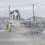
Aired on WUFT June 24th thru June 27th 2012
Flood waters cause aggravation to residents along the Santa Fe and Suwannee Rivers
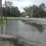
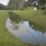
All of the rainfall from what was Tropical Storm Debby is slowly making it way to many of Florida’s creeks and rivers. Several popular North Central Florida waterways are becoming a bit hazardous for public use. Lars Anderson lives where the Ichetucknee and Santa Fe Rivers meet and works as a tour guide with his Adventure Outpost business. He talked with Florida’s 89.1, WUFT-FM’s Donna Green-Townsend. (June 27th, 2012)
Salvation Army sends out help to flood victims
The Salvation Army has deployed seven mobile kitchens to communities flooded by Tropical Storm Debby. Disaster teams from Clay, Marion, Alachua and Citrus Counties as well as Jacksonville and Tallahassee among others are being assembled to begin helping residents affected by the storm. Florida’s 89.1, WUFT-FM’s Donna Green-Townsend talked with the Salvation Army’s Emergency Disaster Services Director Kevin Smith about the help being offered. (June 27th, 2012)
Alachua County asks for public’s help on reporting sinkholes
The Alachua County Environmental Protection Department is encouraging residents to quickly report any newly spotted or potential sinkholes. County officials say the sooner they learn of problems, then the faster they can make repairs. They say with the extreme drought experienced in the past few years, there is increased risk of sinkhole formation as the rainy season approaches. The county wants to avoid any contamination of the community’s drinking water. (June 26, 2012)
Residents can report observations of newly formed solution features by filling out the online form found on the ACEPD website or contact the ACEPD office at 352-264-6800, or send an email to epd-reception@alachuacounty.us
For more information on sinkholes and other solution features, residents can contact Senior Environmental Specialist, Betty Rosenblatt at 352-264-6800.
SRWMD expects Three Rivers Estates to hit flood stage soon
Tropical Storm Debby continues to dump rain across many waterlogged parts of North central Florida. Many low-lying roads have been shut down due to flooding concerns. The Suwannee River Water Management District is expecting the three Rivers Estates area to hit flood stage at the end of this week. Florida’s 89.1, WUFT-FM’s Donna Green-Townsend talked with Senior Professional Engineer for the district, Meagan Wetherington about the situation: Meanwhile, the National Weather Service has issued several flash flood warnings for North Central Florida. Law enforcement officials are reminding remind drivers that if they encounter any flooded roads or rising water, try NOT to drive through it, because it’s hard to know how deep the water may be.
The American Red Cross has opened up shelters for anybody forced to evacuate including one in Bradford County at the Starke Elementary School and in Levy County at the Inglis Community Center behind Town Hall for residents of Yankeetown. In Cedar Key the Rosewood Baptist Church is on stand-by for residents who feel they need to evacuate. (June 26th, 2012)
Bradford County Emergency Management and American Red Cross open shelter in Starke
The Bradford County Emergency Management Office and the American Red Cross have opened a shelter at the Starke Elementary School because of flooding from Tropical Storm Debby. The shelter is for both the general public and special need residents. The shelter, located at 1000 West Weldon Street will be opening at 9 p.m. tonight (June 25). Those needing to evacuate to the shelter are being asked to bring essential items for their family members including:
Prescriptions and emergency medications
Foods that meet unusual dietary requirements
Identification and important personal documents
Extra clothing, pillows, blankets, hygiene supplies and other comfort items
Supplies needed for children and infants, such as diapers, formula and toys
Special items for family members who are elderly or disabled
For more information, contact BCEM Public information Officer Michael Heeder at 904-966-6321.(June 25th, 2012)
Levy County officials remain alert as Tropical Storm Debby begins to move
Levy County officials are at a level two status as Tropical Storm Debby continues to churn in the Gulf of Mexico. The county remains under not only a tornado and flood watch, but a tropical storm warning and a coastal flood warning. Donna Green-Townsend talked with the Director of the Emergency Management office for Levy County, Mark Johnson, about his expectations for the coming days as Tropical Storm Debby slowly begins to move:
(June 25th, 2012)
Heavy rains overnight cause some minor damage in Micanopy area
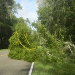
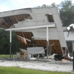
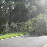
Micanopy, like many other North Central Florida communities, experienced heavy rain throughout the night. The storm conditions brought down a few trees on county highways. The rain also caused the collapse of a roof on an unoccupied building at the intersection of U.S. 441 and CR 234. A few hundred residents in Cross Creek experienced a temporary power outage overnight. (June 25th, 2012)
Progress Energy prepares for damage from Tropical Storm Debby
Progress Energy officials say the slow-moving tropical system, Debby, is likely to cause multi-day outages. Crews have been battling the effects of the storm today and are preparing to repair additional damage on Monday as the Debby continues to pound Florida’s western coastline.
Today crews worked to restore more than 80,000 customers who lost power. As of 9:30 p.m., about 35,000 customers were still without power. Company officials say they expect more outages when the storm makes landfall. Progress Energy provides electricity and related services to more than 1.6 million customers in Florida. The utility has moved crews from non-affected areas to locations where the storm will have more direct impact and is bringing in additional line and service as well as tree personnel from neighboring utilities.
Employees are being mobilized to handle increased customer calls. For Progress Energy power outages customers are encouraged to call 1-800-228-8485. Customers can also use this number to report downed power lines. (June 24th, 2012)
Sharpes Ferry Bridge in Marion County temporarily closed from severe weather
Marion County officials have temporarily closed the Sharpes Ferry Bridge because of damage caused by Sunday’s bad weather. Portions of County Road 314 leading to the bridge, between the State Road 40 and State Road 35 intersections, will also remain temporarily closed. Marion County officials say only local access to the temporarily closed portions of County Road 314 will be maintained.
Crews will be placing signage and barricades to let motorists know the bridge is closed. Motorists are advised to use alternate routes. For more information, contact the Marion County Office of the County Engineer at 352-671-8686 during the regular hours hours of 8 a.m. to 5 p.m. (June 24th, 2012)
Cedar Key residents take Tropical Storm Debby in stride
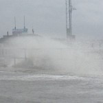
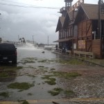
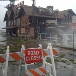
Cedar Key in Levy County is no stranger to tropical weather. The community has had several bouts with strong storms through the years. Chief of Police, Virgil Sandlin, talked with WUFT Meteorologist Jeff Huffman about the damage to the docks and his concerns for the area residents from Tropical Storm Debby.
All the rain inundating Cedar Key gave area kids something to do Sunday afternoon.
Jared Harrington of Cedar Key compared Tropical Storm Debby to past storms and says Debby hasn’t been all that impressive so far. His main goal is to reach out to other residents in need during the storm.
Another person wandering around the streets of Cedar Key on Sunday was a tourist from Groveland, Florida, Valerie Powers.
(June 24th, 2012)
Heavy rain causing dangerous driving hazards on I-75
Many North Central Florida counties are under a tornado watch until 5 a.m. Monday because of Tropical Storm Debby. Throughout Sunday heavy rains caused trouble spots on Interstate 75. The Florida highway Patrol stayed busy working a variety of weather-related accidents. Marion County highway patrol dispatcher Mike Hancock describes what problems the heavy rain is causing.
Hancock says the rain is weakening the soil around trees near the interstate.
Hancock recommends motorists use caution while driving and expect water to be on the highways especially in Alachua County.
Conditions are expected to worsen over the next 24 hours as Tropical Storm Debby continues to move closer to landfall. (June 24th, 2012)
Tropical Storm Debby drenching Florida’s west coast
The National Weather Service and National Hurricane Center report coastal areas of North Central Florida will receive several inches of rain over the next 24 hours as Tropical Storm Debby continues on a NE track in the Gulf of Mexico. The exact track of the storm is still a bit unpredictable. Debby is producing tropical-storm-force winds and heavy rains along portions of the Northeast Gulf Coast. At 10:00 a.m. Tropical Storm Debby was located at 28.0 North and 86.2 West or about 140 miles South Southwest of Apalachicola. Maximum sustained winds are at 60 mph. The present movement is to the Northeast at 6 mph. A tropical storm warning has been extended eastward along the Northwest coast of Florida to the Suwannee River and a tropical storm watch has been issued south of the Suwannee River to Anclote Key.
A tropical storm warning means that tropical storm conditions are expected somewhere within the warning area within 36 hours. A tropical storm watch means that tropical storm conditions are possible within the watch area…in this case within 12 to 24 hours.
The combination of a storm surge and the tide will cause normally dry areas near the coast to be flooded by rising waters. The water could reach the following depths above ground if the peak surge occurs at the time of high tide: Southeastern Louisiana eastward through Apalachee Bay, 3 to 5 feet. Florida’s west coast south of Apalachee Bay, 1 to 3 feet. Southwestern Louisiana, 1 to 3 feet. The deepest water will occur along the immediate coast in areas of onshore flow. Surge-related flooding depends on the relative timing of the surge and the tidal cycle and can vary greatly over short distances.
Tropical Storm Debby is expected to produce rain accumulations of 5 to 10 inches along the immediate Gulf Coast from Southeast Louisiana to the Central West Coast of Florida with isolated maximum amounts of 15 inches. Given the recent heavy rainfall and wet soil conditions, these additional amounts will exacerbate the flash flood threat across portions of the Central and Eastern Gulf Coast.
Isolated tornadoes are possible over portions of the West-Central and Southwestern Florida peninsula today. Keep checking with WUFT.org throughout the day for updates. (June 24th, 2012)
