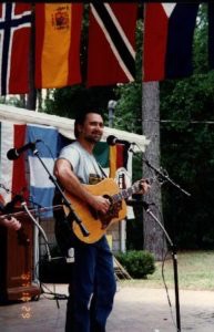
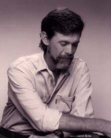
All posts by Donna Green-Townsend

Interview transcript for Matthew Kales

Matthew Kales, Program Director at Upper Chattahoochee River Keeper (speaking with , reporter Joshua Azriel)

Azriel – I’m here with Matt Kales, please tell me your title.

Kales – I’m the program manager for river basin protection with the Upper Chattahoochee River Keeper, and the primary bulk of my duties focus on the tri-state water wars coordinating all the conservation NGOs in both basins to address the issues that are emerging as part of the water wars.

Azriel – How long have you been active in this issue?

Kales – Over a year. Prior to coming here to River Keeper I worked for an organization called the Georgia Conservancy which is the oldest state wide conservation NGO in the state of Georgia and one of my duties there as a water policy analyst was tracking and analyzing the water wars in both basins and developing policy for my organization on those issues.

Azriel – How long have you lived in Georgia, are you a native?

Kales – I’m not a native, I’m a Yankee, I come from Boston. I came down to the University of Georgia in 1996 to pursue my masters in the dept. of Geography and actually the tri-state water wars was an issue that in my studies in the context of water resources geography I looked at quite closely so I was well acquainted with the issue before I started working on it professionally.

Azriel – Now you call it the tri-state water wars. Is that a nickname you called it or is that how it is commonly referred to in all the three states?

Kales – That is very much the colloquial name. I don’t think you’d necessarily hear the official belligerents themselves whether it was the negotiators or the team leaders for the various states involved or the federal agencies involved call it the tri-state water wars. I think lately there’s been an effort to downplay the more bellicose aspects but that is very much what it is and what we refer to it in the conservation community but the technical name, the ACF ACT Allocation Negotiations, of course that stands for Apalachicola Chattahoochee Flint and Alabama Coosa Talapoosa River systems and the process by which they are going to be divided amongst the various states.

Azriel – Is this what you studied getting your masters in geography?

Kales – This was a case study I looked at. My studies focused on inter and intra state water resources conflict based on quality and quantity. This is fast emerging as a classic example. In fact, a gentleman at the Univ. of Alabama, a geographer named Aaron Wolf took his students through this case study as an example of how to resolve and settle peaceably interstate water conflicts. He has since moved on to Portland State but anyway this is regionally the hot bottom issue and the really classic case study for this type of interstate problem.

Azriel – In general what is the Georgia perspective on pollution issues related to the Chattahooche River?

Kales – Let me ask you when you say Georgia are you saying institutional perspective from the state of Georgia or the conservation NGO perspective?

Azriel – Let’s start with the institutional and then we’ll go the conservation perspective.

Kales – I can’t report to speak for the state of Georgia but it’s our read on the Georgia proposal and as a member of the Georgia Governors Advisory Council on Tri-state water issues that Georgia’s approach to this issue is through a reservoir operation and management scheme. Basically this is a heavily regulated system and when I say that I mean there are a lot of dams, a lot of reservoirs, a lot of structures that as they’ve been built over the years have altered and regulated the natural flow regimes in these systems the way in which the river initially evolved and the critters that lived in there adapted to it. The dams and the reservoirs that were built for hydropower, navigation, water supply, and now they’ve become used for recreation have been hit upon as the mechanism about which to allocate water seasonally during periods of draught during higher flow periods and Georgia’s idea is to manage the reservoirs in the system as a whole as if draught were imminent, keep as much water as possible behind the dam while meeting the needs of downstream neighbors. That’s what this whole compact and allocation formula is about. The idea is to store water, trap what precipitation we can and keep it behind the dam for future use in periods of draught.

Azriel – And the NGO perspective?

Kales – One of the things that we’re really focused on here and Upper Chattahoochee River Keeper has been a critical player I think over the years in getting this language and these concepts both in the compacts itself but also in the general dialogue are the issues of water quality and biological resource issues. There’s also an issue of flows that we’re concerned about that affect both water quality, biological resources, and of course recreation and aesthetics as well. What we’re interested in seeing here is an allocation formula that equitably apportions the waters, provides the water we need for municipal and industrial use, for drinking water for example for waste water assimilation but also provides for adequate and even enhanced and restored water quality in certain reaches of the river throughout the system where we’ve had water quality problems and provides the flow in terms of quality, quantity, and timing for the aquatic animals and biological resources that are dependent and rely upon certain flow regimes for propagation for spawning and for various stages of their life.

Azriel – Are you talking about specifically for Georgia or for all 3 states?

Kales – No though we’re an organization based in Georgia and our purview is defined largely by the upper basin, we’re very much aware and concerned about the downstream impacts of what happens in the headwaters areas of the basin. So anything that occurs here whether its south of Buford dam in the metro Atlanta vicinity or south of the city is ultimately going to have an impact downstream all the way to Apalachicola And that’s a very real and a very important part of our activities and an important part of our approach to these issues.

Azriel – What are the main concerns here in Georgia about water allocation?

Kales – OK again without pretending to being able to speak for the state of Georgia per say, it’s my impression and the impression of most of the conservation NGOs involved in this issue that one of the drivers if not the primary driver for Georgia’s approach to allocation is metro Atlanta MNI municipal and industrial use. That’s the water that goes to water our lawns, for drinking water, to wash our cars, for waste water assimilation for industrial permits, those people that discharge directly to the river. I think the idea here is Georgia has experienced explosive growth. After W.W.II in the post war period but really in the last 20 years the demographic growth, the forecasting here has exceeded everybody’s wildest projections.

Just the other day, a colleague of ours at EPA looked at some of the intercensal, the numbers that come out between on demographics, between the census 1990 and the ones coming out in 2000 and we’ve already surpassed growth in most of the counties north of Whitesburg which is a key caging station on the Chattahoochee River…the point I’m trying to make here is that we’re really fast running out of water, that’s something the state of Georgia has admitted, the state of Georgia has acknowledged and we need to look for alternate sources of water. And the Chattahoochee can only support so many people in the metro Atlanta area and all they require in terms of water.

On the other side of the coin, as I alluded to earlier, those in the conservation community are very concerned that any allocation formula that’s developed by the states and approved by the federal agencies has in it provisions for water quality, for biological resources, for recreation, for uses what we call in stream uses not your instrumental off stream uses for say watering lawns or industrial processing etc. but the uses for the natural system that require water.

Azriel – Have there been any proposals to, I know metro Atlanta encompasses looks like close to 10 counties.

Kales – There’s actually 13 county planning area for the Atlanta regional commission but there’s effectively 20 counties because of their growth and because of the sprawl and development here in the metro area have become again effectively part of the metro Atlanta area.

Azriel- Are there plans on the books to try and slow the growth or is it a matter of we are going to take it as far as it can go?

Kales – Atlanta has become by all accounts and I am paraphrasing here from other folks but a poster child for sprawl. Now sprawl is this pattern of development we’ve seen more and more in parts of the U.S. where there are no natural barriers to growth where land use is unplanned and land use is aimed primarily at expediting economic development with little concern for its environmental effects whether its tree cover, open space, water quality, air quality, and just general quality of like. And while sprawl has not been a major part of the dialogue in the official negotiations here its very much a parallel track. What’s happening in the metro Atlanta region is very much being born out in the tri-state water wars because you have a region whose explosive growth and until recently refusal institutionally to deal with that explosive growth and manage sprawl and manage expansion in a way that’s not detrimental to the environment has resulted in a shortage of water, has resulted in a projected short fall of water resources I should say, and resulted in a direct confrontation inter-state confrontation and also there’s another issue we’re not really addressing here and that’s the intra-state allocation of the Chattahoochee River and its tributaries. Basically you’ve got two very different Georgias. You’ve got an urbanizing north Georgia that’s basically represented by the metro Atlanta area and then south of the fall line or the nat line as we say you’ve got largely rural agricultural Georgia that’s largely dependent on these water resources for its agricultural economy.

Azriel – Where is this line where it becomes rural, Macon?

Kales – Well I mean Atlanta is funny because you can drive south fifteen miles from the heart of the city into South Fulton and you wouldn’t know you’re in one of the fastest growing metropolitan areas of the U.S. It’s fairly bucolic, you’ve got farms, it’s quite rural. But south of Columbus is where we really start to look. It’s a geographic and physiographic divide, it’s call the fall line where the land slopes precipitously from a piedmont to a coastal plain, um, but it’s also very much a cultural and economic line as well and you start to get into the more agricultural rural environment much like you see in the panhandle of Florida. Many people who live down there have claimed they’ve got more in common in terms of the physical environment, the economic environment, and the socio-cultural environment with Florida’s panhandle at that point.

Azriel – Is there conflict within the state of Georgia between the farmers versus the demands of Atlanta and how that should be handled in this inter-state conflict?

Kales – I think there’s a growing concern and its been manifested at several regional water resources conferences and leadership symposiums in S.W. Georgia whereby farmers and agribusiness interests, economic development interests in S.W. Georgia, who rely as you said, upon the Chattahoochee and Flint Rivers but particularly the aquifers, the subterranean ground water resources there, are beginning to see that their water resources needs and requirements may well be sacrificed on the alter of metro Atlanta MNI. That is to say that the water demands upstream in the urbanized areas particularly metro Atlanta may supersede in an allocation formula the needs of the SW Georgia largely agricultural interests to the point that there will be caps placed upon the amount of water that farmers can withdraw out of what is called the upper Floridan aquifer which is the major ground water system in that region.

Azriel- From what I’ve read Alabama’s point of view is similar to Florida’s with regard to Atlanta’s growth.

Kales – Well I think there’s a general concern that because metro Atlanta is situated on effectively the head waters of these basins, it isn’t technically in the head waters but its far up stream in comparison to Alabama and Florida, that anything that happens here to impact water quality or water quantity could conceivably adversely impact interests down stream be it economic interests in the Apalachicola Bay the oyster fisheries and harvest areas down there or economic development in Alabama. If you don’t have enough water to grow you can’t expand your urban bases and economic bases in Alabama. It’s, I keep referring to the economic aspects of this issue but that’s what its really become in many ways.

Here in the conservation community we’re extremely concerned obviously about the ecological aspects, the public health impacts, the recreational impacts, the more traditional impacts you might see from a river basin management scheme. But what it comes down to and many folks’ opinion and mine is this is largely an economic conflict. Water has become a vehicle, an incredibly important component for our economic development in this region. We’ve entered into what is really a paradoxical situation. We’ve got a temperate region with as much as 52 inches of precipitation annually which makes, obviously out west its much more arid but, what we have is a seemingly abundant water supply but because of recent demands, due to urban growth due to some degree to water quality, how we’ve treated our waters resources we’ve suddenly realized we don’t have as much water as we think we had and its resulted in this very tense and at times controversial and belligerent situation.

Azriel – If there are no efforts down the road to slow Atlanta’s growth how can any compact deal with this?

Kale – Well if its written in the compact, supposedly its written in stone to the degree that the participating states need to abide by the formula whatever that might be i.e. Georgia needs to deliver a certain amount of water at certain times of the year at certain designated locations. Now that still needs to be hashed out, that’s turning out to be a real bugaboo technically. Where that water’s going to be delivered, how it’s going to be delivered, and here’s the real crux how its going to be monitored and how its going to be verified. This verification issue you probably know is become as you know real potential wrench in the wheel here. And if there’s a compact and for it to be adhered to, Atlanta has to find some way to meet its water resources demands through conservation which is a conspicuously absent component of any dialogue. We’ve not heard anything about aggressive water conservation here.

The Atlanta regional commission which is the planning body for the metropolitan area has stated as much as 10 percent of future water resources needs in the Atlanta region will have to be met by conservation, but we don’t see any steps in that direction addressing water quality so that water that goes down stream will be viable for down stream users that’s another way that Atlanta can think about conserving its water resources. And finally just finding a way to live within its means, what we’re seeing here is a metro area that is writing natural resources checks, its writing growth checks that it can’t cash. We’ve exceeded our carrying capacity and the tri-state water wars is very much a wake up call to that affect.

Azriel – As it stands now from people I’ve spoken to in Florida, the Apalachicola River and Bay is fine, there are no problems with it. Their concern is the future, 30 or 40 years from now. How does one plan for that far down the road?

Kales – That’s an excellent question Josh. Florida if you look carefully at its proposal has proposed an interim allocation formula and what we believe that really represents is something called adaptive management. Adaptive management is an eco-system concept or tool that is fairly self explanatory. The idea is you take a system and you put a management plan in place, you implement it and you monitor very carefully what the feedback from that system is. If you’re delivering for example certain amounts of water at a certain place, you look at the biological and the chemical composition of that reach of that river and you see how its fairing. Is it being enhanced, is it being adversely impacted and then you adjust accordingly. It’s a very logical way to manage a system because the reality is these systems they have evolved over time, they’ve adapted over time and you can’t just go ahead and tweek them due to human requirements and human needs and expect them to just fall into place. You really need to be careful in terms of how you manage the system.

Adaptive management is one way we can assure we’re basically managing the system in an ecologically sound fashion. So Florida’s approach to that some of the other conservation groups including the nature conservancy have been very vocal about the need for adaptive management. River Keeper has promoted this concept as well and we really hope that Georgia, Alabama, and Florida take into account this need for adaptive management when they come up with their final management plan.

Azriel – Based on your involvement with this issue, what seems to be the general attitude Georgia has toward Alabama’s and Florida’s needs?

Kales – Well, it’s been a real interesting dynamic because traditionally if you go all the way back to Babylonian era if you have water wars whereby the upstream entity could control all the shots, but the specter of litigation, the need to manage public trust resources, and I think the awareness that upstream parties have a basic and fundamental responsibility to deliver water with adequate quality and quantity downstream has changed that dynamic and forced a cooperative partnership. There are political tensions that are only now being daylighted between Alabama and between Georgia. There are long standing rivalries over various issues that have manifested themselves in this process and that to some degree has obstructed some process in the negotiations.

Azriel – Has your organization proposed solutions to this?

Kales – Well in several comment letters to the Georgia negotiating team to the federal agencies including the Corp and as well as the governor of Georgia, River Keeper has proposed adaptive management, the need to provide for water quality and biological resources concerns all the things we discussed earlier as being primary to the conservation NGO focus and approach to these issues. It’s more than about just delivering a certain amount of water at certain time downstream for instrumental uses.

Azriel – Can you explain what adaptive management is?

Kales – Adaptive management is a very basic ecosystem management tool or concept whereby you monitor a system after a management plan has been implemented. You see what the feedback from that system is chemically, biologically, economically, and then you adjust accordingly so that management plan is ecologically sound in the best interests of the water dependent entities.

Azriel – From the point of view of your organization, are the negotiations on the right track?

Kales – Well we are definitely apprehensive about some of the technical difficulties that have recently come to light in terms of verification, in terms of the lack of adaptive management until recently that we saw for example in the Georgia plan. More recently we’ve detected also more bellicose tone in the Georgia negotiating team as far back as the General Assembly in February March. Briefings that were until then much more constructive and conciliatory began to take on a litigious tone which suggests to us there’s simultaneous tracks here. There’s a negotiating track but there’s also a potential litigation track that’s being prepared for.

Azriel – With regard to the tracks, what would be litigated?

Kales – That’s an excellent questions. A lot of what we could say at this point about litigation is speculative, and I’m hesitant to go into it because we’re still in the conservation community exploring whether litigation would be ultimately beneficial for our goals i.e. water quality and provisions for biological resources and a natural flow regime. It’s been suggested by experts who have experience in Western water wars which have sort of set the precedent for interstate and intrastate water allocation in the U.S. where obviously water is much more scarce and more contentious of a resource that were this to go to court it would go to the Supreme Court and it could take as many as ten years at great expense in both of terms of building a case and prosecuting a case as it were, but also the expenses incurred by the participating states. You’re talking about states that are heavily dependent economically on these water resources.

Metro Atlanta is the obvious example but as we discussed Apalachicola Bay requires certain fresh water inflows to keep the oyster fisheries and some of the other fin fisheries robust and economically viable. If this thing goes to court and water resources development project sup and down the river of any type are placed into suspension due to a moratorium, it could really adversely affect the region. Water is the lifeblood of this region, in some ways as much as the West even though there’s more of it here we’ve recently realized it’s a lot more scarce supply than we previously thought. There’s a gentleman or woman that would be appointed river master and this is a Supreme Court designate that would take 10 years…

Azriel – U.S. Supreme Court?

Kales – Yes, federal, U.S. Supreme Court would take 10 years to assemble all the facts in this case and that would really bog down this region in terms of its water resources development.

Azriel – From what I understand there’s a December 31st deadline. In Georgia there’s the farmers needs versus metro Atlanta and then Alabama and Florida’s needs. Do you think they’ll meet the deadline?

Kales – Before I answer that let me back up and say urban growth versus the farmers, it’s not so polar as that it’s not as binary, there are a lot of other interests and it’s a lot broader a scope within the urban context and the agricultural context. Those within the state are two of the primary water users vying for control of the water but there’s also obviously water quality aspects throughout the entire basin in all reaches of the river. There’s water supply, there’s recreation, sport fishing, paddling, aesthetics, and the biological resources. There’s also hydropower, navigation, you’re beginning to get a sense of how complex these allocations are. So don’t be misled by farmers versus urbanites it’s again a lot more complicated than that. This is as you know going into the 6 months of the extension, the allocation formula was originally to have been developed completely and ultimately approved by December 31st of 1998, that was stated in the original language of the compact. Whether or not they’re going to be able to pull it off…

Azriel – 1999

Kales – 1998 was the original deadline…

Azriel – OK

Kales – At the end of 1998 December 31st the states received with the acquiescence of the governor and the feds an extension. 12 more months to allocate the water, to come up with a formula. And what happened thus far is due to technical difficulties, logistical difficulties, staff shuffling in Alabama, and obviously a gubernatorial change over in all three states progress has been really slow. And for any formula to be put out in draft form for public comment and then put to the feds including the Corp for analysis, evaluation, and ultimately concurrence by the federal commissioner they have to have something on the table by early October. At this rate we don’t see that materializing in sufficient time but we remain optimistic hope springs eternal.

Azriel – If they fail it goes to the Supreme Court and the river master would be appointed, correct?

Kales – That’s one component of it. There seems to be a sentiment in each state and again this is speculative that each state is in the right. Georgia may feel like they’re in the right because they are at the upstream position. They are where the rivers rise in the headwaters. So its their god given right to take whatever water they need for their uses. Alabama and Florida as downstream entities may feel the exact inverse of that. They feel the dynamic is such that Georgia has an obligation to deliver a certain quality and quantity of water downstream.

So this entitlement, this issue of sovereignty over water resources within one state’s boundaries is fundamentally at odds with the nature of these river systems because as your well aware having been down to Apalachicola what we call the end of the pipe, these river don’t respect the state line. They rise where they want and they flow until they’re obviously dammed generally where they want and when they cross the border in Florida when they flow out of Lake Seminole for example the rivers don’t know in what state they are, they only know that they are continuing on their natural course. And so this overlay of a political context with artificial state boundaries and then intrastate boundaries whether its counties or municipalities or in Florida, water management districts which of course are based on a drainage system a little more logical, really are again at odds with the way these allocation formula negotiations are preceding.

Azriel – Is there anything you’d like to cover we’ve not covered yet?

Kales – I think one of the things we need to touch on is more of a philosophical issue with regards to these allocations. They have been controversial, they have been tense. Litigation has become a very real specter but one thing that we really need to keep hitting on and harping on and promoting is the opportunity that exists here. There’s an incredible potential to manage these basins which by the way happen to be amongst the most bio-diverse temperate freshwater ecosystems in the entire North American continent.

And up until now this whole issue or these suite of issues have been painted as this behemoth, this incredibly complex miasma of inter and intra state allocation, but what it really is an opportunity to set a precedent for basin management with an adaptive ecosystem focus to show the rest of the region, the rest of the country, and indeed the rest of the world, all of whom are watching this issue very closely, it’s gone from a little backyard dispute to a very important global issue, that these type of ecosystem management and base management plans can be developed cooperatively with the proper provisions for water quality for biological resources, you can manage the basins for instrumental i.e. human uses while at the same time keeping them in an ecologically sound and fairly natural rhythm.

Azriel – Are other regions of the country are watching to see what will happen here?

Kales – Undoubtedly, when this thing first evolved, when these wars first broke out, experts from all over the country but particularly the arid Southwest were brought in to consult with the various states and form the federal purview. Some of the legal background has been done by folks from New Mexico, Colorado all of whom have significant expertise in these western water wars where allocation is a very different game, a different animal because you’re dealing with what’s called prior appropriation. In the West if you set up on a stream you had those rights for perpetuity. Here in the East, east of the Rockies, we have something that’s based on Riparian law which is derived from English common law. It’s basically your entitled to a certain amount of water as an on stream user but you have to pass enough water downstream for the use of your downstream neighbors. So that’s the kind of framework or dynamic we’re operating under, and I think yes very much people are watching this again not only regionally but nationally perhaps internationally as well.

Azriel – What else would you like to add?

Kales – One last thing that I think gets lost in the shuffle as the states argue over sovereignty and who has the right to what water is that the waters and the resources in these basins constitute a public trust resource that is, it should be managed for the ultimate benefit of the people and the other inhabitants of these basins whether they’re aquatic resources or people who use them for recreation and that needs to be I think constantly…people need to be reminded of that fact as we pursue these negotiations so that we can truly equitably apportion these waters.
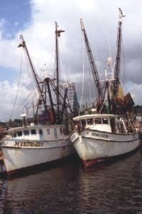
 

Interview Transcript for Steve Leitman

Steve Leitman, Environmental Scientist, NW FL Water Management District (talking with Joshua Azriel)

Azriel – How many years have you worked for them?
Leitman – I ve worked for the district for the last six years, but I ve worked on this issue for the last 24 years including for about four or five years when I worked with Florida Defenders of the environment as the Apalachicola river coordinator.

Azriel – Okay, and tell me a little bit about what the Florida Defenders of the Environment does.

Leitman – FDOE is a non-profit environmental group based out of Gainesville and was originally an organization that was a group of University of Florida professors opposing the construction of the cross-Florida barge canal, so it was an interdisciplinary group which really focused on bringing technical information and challenging technical information in decisions by the government.

Azriel – Well first, what are your thoughts about the agreement between the three states regarding the Appalchicola, the Chattahootche and Flint rivers?
Leitman – Okay there are several things we need to think about regarding this agreement. First, its fairly monumental in several ways, first of all this is the first river basin commission created in the southeast portion in the United States and the first since passage of the clean water act in the 70 s and so this was created in a completed different context than other river basins such as the Potomac, or the Delaware river which currently exists on some of the planning commissions. Another important thing to realize with this larger agreement is that in this river basin we are trying g to deal with issues when the ecological integrity of both the Apalachicola river and Apalachicola bay are still intact, so its this trying to deal with things before the fact instead of after the fact, its proactive instead of reactive. And when you take a proactive approach its cheaper, you have more options and probably have better results and so if we look at the problems I think looking at the overall issues is that people should be commended for dealing with this issue so early.
Azriel – What do you think the most important function of the committee that will be organized from it?

Leitman – Well, in the short term the most important function is defining a water allocation formula which when we created the compact legislation, we purposely left out the formal so that it could be defined by the committee and the reason for this is that we have to take more of an adaptive approach and you have to be able to learn and amend such agreements and experience has shown that in agreements when you write it into the agreements, it s a direct ticket to the Supreme Court because their will be errors. A good example of an error is in the Colorado River where they allocated about 140 – 150 percent of the river s flow and naturally the upstream states thought they d get there s and that meant the downstream states didn t get theirs and everyone ended up suing each other and so by setting up to have the commission define the formula and be able to amend the formula instead of writing to the legislation at least you make this concept of adaptive measurement possible. In the long term though the important thing will be whether they ll be able to take this adaptive approach, It s the whole idea of whether they re going to be able to do research monitoring, learn, amend and live with the system or whether they re just going to try and fix something.

Azriel – What was it about the allocation amongst the three states in the first place that needed to have this set up?

Leitman – Well, from a larger perspective first of all, if you look at the Federal laws there s, we have a clean water act which at least sets up standards of how to deal with water quality although sometimes it s not done to the satisfaction. At least there s Federal legislation that allows it, whereas from a quantity aspect you really don t have system wide standards for dealing with quantity of flow and so I would say that s a pretty important aspect of it. And it s important when you look at Apalachicola river, Apalachicola bay that you realize the real drive that makes everything work is flow in terms of the flow plain it s the extent and duration of flow and in terms of the estuary the salinity regime is really the important driving function that defines the whole Eco-system so the salinity rege defined by the Apalachicola river which in turn is the flow of the river.

Azriel – What is the salinity regime?

That’s when I talk about salinity regime or flow regime I m speaking of the concept that over the course of the year the Apalachicola river flow will vary eight to ten fold in a typical year and between, from year to year you ll get variation. And what this results in is a pulsing of salinity, you don t have a constant salinity level in the estuary, but you have a changing salinity , and a lot of the species that live there in fact all of them are adapted t this concept of change both in terms of the elevation of flow or the flood plain being flooded sometimes, being dry sometimes and the estuary of pulsing salinity regimes. In fact if you looked at oysters for example, you ll l find that much of the diseases associated with oysters are marine in origin, which means if you have this pulsing regime you re constantly pushing the marine uh, antagonists away from the system.

Azriel – Interesting. Uh, for the listener who really doesn t know a lot about how rivers are connected, um, how the activities in one state can affect things downstream, what do you think the danger is right now, the potential dangers are right now to the Apalachicola River?

Leitman – Well, the Apalachicola river is roughly a 20-thousand square mile drainage basin and if you look at that basin and divide t state to state you ll see that about 75 percent of that drainage basin lies in Georgia, about 12 and a half or one-eighth lies in Alabama and a similar one-eight lies in Florida, so a flow is sor rivers that lie along Georgia and Alabama, one of them is the flint one of them is the Chattahootche, and these two rivers are very different in nature. The Chattahootchee River is fed mostly by overland flow and the Chattahootchee River is fairly highly regulated up in the upper parts of the basin. We have Lake Lanier which has roughly 75 percent of the storage, two thirds of the storage excuse me in the basin and it impounds 10 percent which means the river is highly regulated up by Atlanta but when you get down toward the lower part you have fewer reservoirs greater drainage area and its not so regulated. So the Flint is an impoundment system with service overflow, I mean the Chattahoochee, the Flint in contrasts flows through a carst area and has a large groundwater inflow from springs and such. And that means the flow during low flow naturally is more constant because it had this ground water influx that was happening and in the Chattahoochee basin we large withdrawals happening from metropolitan Atlanta you have cities of Columbus, you have reservoirs. In the Flint Basin you don’t have the large municipal withdrawals but what you do have is agricultural irrigation which has grown tremendously since the 70s and so and they mostly irrigate from shallow ground water wells and you set up pivot type systems and the result is although its a really robust aquifer that seasonally especially during dry years were dropping down the aquifer and that in turn causes loss of flow into the Flint or from the Flint back to the aquifers in extreme cases. And that consequently both of those could be effecting flow in the river in the flow regime.

Azriel – Isn’t Lake Lanier a man made lake?

Leitman – Yes.

Azriel – Do you know when it was built?

Leitman – It was built in the 50s. There’s roughly 15 reservoirs in the basin and only 4 of them have storage and the storage type of reservoirs, there’s two types, one of them will have storage which means they can hold water and release it on schedule and then a number of them around the city of Columbus which is at the fall line coming from the Piedmont to the coastal plain ah those are power type reservoirs where flow in equals flow out so although they effect locally they’re not altering the flow.

Azriel – How does the Apalachicola River compare with other rivers in Florida.

Leitman – In terms of flow, the Apalachicola is by far the biggest river in Florida. Its average annual flow is three times that of the Suwannee River which is the next biggest in terms of flow so its discharge is really large and if you get into flood stage you can get over a 100,000 cubic feet per second flowing down which translates roughly into15 billion gallons per day and so there’s a lot of water coming down that river.

Azriel – How does it compare with its biological diversity?

Leitman – Uh, the Apalachicola River is a very diverse river. There’s a number of reasons one of them being because its water shed extends far up into Georgia that it gets biotic influences from the Appalachian mountains from the Piedmont and from the coastal plain. And then its location is one that causes a really diverse biological community because its getting biological influences from both the Atlantic and the Gulf coastal plains from peninsular Florida from the Piedmont and from the Appalachians and so you have all these five bio regions throwing influence into this one area and the result is a very diverse ecosystem.

Azriel – What dangers does growth around Apalachicola pose to the rivers and its tributaries and the bay?

Leitman – The danger you would have would be is that the introduction of if you have a lot of places with septic tanks. Septic tanks, the way Florida’s septic tanks law works is first of all they’re not concerned with system effects they’re concerned whether each additional one will drain and its not the issue if we have too many individual ones draining what happens. And being able to trace the effects of each one individually and say which house throws you over the where you start to have the problem is the question and then its also that there are important nursery areas that could lie near the shore. Now one of the things it has going for it is it is a well flushed bay, its not like say neighboring Saint Joe Bay which has slow flushing time because there’s only one inlet and outlet whereas the multiple inlets in the large flow and large amount of water flowing through it there’s a flushing so things do get flushed out of there.

Azriel – Is there a danger that development will grow and grow?

Leitman – Oh absolutely there’s a development, it’s a region that has tended to have a fairly depressed economy. Sea food landings fluctuate from year to year to year and you have people definitely sort of buying out the historical culture and going in and putting in a new culture which is more tourism oriented.

Azriel – Do you know how much of the land is federally or state owned which cannot be developed?

Leitman – There’s uh extensive amount of land has been purchased by the government. If you start first at the estuary and look at the islands there’s a large chunk starting from east to west. Dog island, the nature conservancy owns a large tract of land on Dog Island which is zoned just for conservation and then coming to the next part you have on both ends of St. George island you have a park on the east end on the west end you have little St. George island which used to be part of St. George island they put sykes cut in is state property. And then the next island over, St. Vincent, is a federal reserve. So a majority of the barrier island system is in conservation s lands. Then when you start looking around the bay there’s a lot of land which has been purchased for CARL – Conservation and Recreation Lands – environmentally endangered lands programs years ago and then the NW Florida Water Management District has also been purchasing extensive lands in the Saver Our Rivers program. And so the end result is I think 120, 130 thousand acres of lands either flood plain, barrier island or marsh estuarine lands have been purchased to try and provide buffers from development.

Azriel – Tell me about some of the marine life besides the oysters.

Leitman – Well in the estuary you have three types of shrimp and its also a very important nursery grounds for the Gulf of Mexico so when you look at value of these estuaries sometimes we get misled because if we look at just county landings but if its nursery grounds there’s a lot of species that this is where they grow up but when they’re harvested, caught, it could be out in the Gulf of Mexico and landed wherever and its also important for a blue crab and if you go up the river there’s also sturgeon, the Atlantic sturgeon, and we have special Gulf race of strip bass as well as hybrid bass as well as a number of other species and then there’s the number of clams that are pretty significant.

Azriel – How does the river help in raising the Tupelo honey?

Leitman – Honey is a big product in the Apalachicola basin you know the most noted is the Tupelo and there’s an extensive, its because of the flood plain, Tupelo is a flood plain tree it likes it wet and there’s broad Tupelo forests in the lower part of the river which allows for the harvesting of Tupelo honey, which is one of the better honeys you’ll ever run into. And with the protection of these lands by the state, the state allows the bee keepers to go in there and set their hives and pull in the honey and then leave and so this means of sustainment of this industry.

Azriel – With the land that is controlled by the state and the development and seasonal tourism, what kind of balanced will be struck do you think?

Leitman – Well the amount of land you can actually develop either in Apalachicola or on the island is quite limited really and where the balance would be that’s a hard one to say. You’re going to find they run into the problem with a lot of wet area with a lot of public lands and all. I think you’re going to see land prices getting higher and higher there and I think you’re going to find a balance but one of the things I think you’ll find in this balance I fear is with the increasing land prices, the increasing cost of living that you’re going to have a transition of the culture and so that the original inhabitants are going to get displaced or the original culture.

Azriel – Do you work with the economy of the Apalachicola area?

Leitman – Years ago I used to be more involved with that, but my work presently has been very much tied to this interstate negotiations and dealing with the water and that has been such, there’s only so much you can do and really know about.

Azriel – I understand a lot of the tourists come from Georgia, should residents in Florida be concerned with the development up in Atlanta and how it could affect the waters?

Leitman – I think that you know more than development in Atlanta, I would say development in Georgia…

Azriel – In general

Leitman – is a question that what’s the sum or what’s the cumulative effect of all the actions that are going to be happening up stream and how they are going to reflect the flow regime 10, 20, 30, 40 years from now and it gets down to is are what we going to be able to really pass on our cultural heritage to our children to their children to their children passing it on for generations or are we going to keep eroding away at the flow regime.
Azriel – Where does a danger lie?

Leitman – OK well you’re seeing tremendous growth by metro Atlanta and huge population increases and really no efforts within Atlanta area visible to me of constraining the growth, they are in a lets grow mentality and at the same time you have a lot of other demands you know going down the Chattahoochee River at Columbus you have industrial demands industrial uses and then you have the storage reservoirs and they have let people build around these reservoirs and a good example of what can happen with this is this is at Lake Lanier that has roughly two thirds of the storage capability in the basin but unfortunately it is located in the upper part of the basin so consequently that means if they drain down their storage it takes longer to refill because of the amount of area they can gather rainfall to refill. But the other thing they’ve done is in having people live around it, people who live around reservoirs tend to be wealthy, they tend to have influence and they tend to not like the idea of seeing their reservoir fluctuate 36 feet. They’d like to have a dock, they like to go out in the evening when they go out boating and not have a mud flap but have the water. But consequently although Lanier, Lake Lanier, is set up to be managed to fluctuate 35 feet if it changes 4 feet the people around it are screaming saying you can’t lower it anymore. And so a lot of this management capability that was paid for by tax payer money really has turned around to become lake front capability for the residents of the area and the more you have the city of Atlanta taking demands of water supply both from the lake and from the river itself the less water that’s available from the downstream uses.

Azriel – Going back to the commission and its creation, how many years was this in the works?

Leitman – That depends on you define the start of it.

Azriel – Give me your interpretation of it.

Leitman – My interpretation is this has been going on for 15 years and there were several false starts on the idea of how do we get this grip on system wide management and each false start whether or not it resulted in us getting there, there was information and things we were learning so the next time we got into the game we would be able to do better. This most recent round started in 1989 1990 when the city of Atlanta came forward and said they wanted to reallocate water from Lake Lanier from hydropower which would essentially get released for downstream uses to water supply which would be held for water supply for metro Atlanta drinking water and at the same time while doing this environmental impact statement because it was a federal action required by the corps of engineers they came forward and said they were going to release new reservoir manual, reservoir water control plans which would define how they actually manage the reservoirs instead of how they are supposed to under in their older water control plans. And the end result of this information coming out was a law suit saying that the environmental impact statement was inadequate and we reached this junction then of do you go to court and demand a good environmental impact statement or do you negotiate for what you really need which is how do we manage water needs from a system wide context. From a Florida standpoint I felt we didn’t need a good document I felt what we needed was a grip on how to manage it and so this whole law suit led to a four five year study effort and that was important in the process for several reasons. First of all the parties involved were able to develop joint databases and joint tools so that when we are talking to each other, analyzing each other’s approaches we can understand what each other is doing, it provides a common language. A second part that’s important in this that’s overlooked a lot is that in our society we really do not think from a system context and most people don’t and if expect basins such as the Apalachicola River to be managed in a way that very few people think is presumptuous, what this five year period did was it allowed this development of a mentality or a consciousness in the basin where people could start seeing it more as a whole system. When you go and to meeting that has a broad variety of stake holders and you listen to them talk now and compare it to what he heard 6 years ago, its pretty amazing the development and the way people are starting to see things in a different way, its this education and so this is one of those subtle benefits you get in this process.

Azriel – How is Florida treated in the negotiations?

Leitman – I think that we had the rap on us of “Oh they just want to the protect the environment, the birds and the bees, they’re the radicals down south” if I was to be honest about it and uh I think that the perception of us was they were the moderates and we were these environmental radicals down south. To this day I still don’t see what’s so radical about wanting to pass our heritage down to future generations, to me that’s the conservative approach not the radical approach.

Azriel – How much of what is in the Gulf is impacted by the Apalachicola River?

Leitman – I don’t know how you’d say how much in the Gulf of Mexico. The vast majority of the species in the Gulf of Mexico are what you’d call estuary dependent that doesn’t mean they live there all the time but it could be for example they use the estuaries for nursery grounds and its important they have a place for their young to grow up till they reach an age they can survive out in the open Gulf, or that they’re not preyed upon so by other species so easily and so I think the number I’ve seen is like 95 or 98 percent of the species in the Gulf of Mexico are estuarine dependent meaning they spend some part of their life cycle. Now taking that…

Azriel – Spend part of their life cycle…

Leitman – In an estuary

Azriel – OK

Leitman – such as the Apalachicola, an estuary being an area, a semi closed area where fresh and salt water meet. But to say what percentage in the Gulf of Mexico I don’t know how I’d you a number, any number that you put with that I think is grab of the sky.

Azriel – Let me try this question from a different point of view. What goes into the Gulf of Mexico from the Apalachicola River any more special than any other estuaries?

Leitman – I think that you find because you have a large river that Apalachicola is extremely productivity per unit area basis because its sort of a custom designed estuary. You have the barrier islands which are trapping the nutrients trapping the fresh water to create the salinity regime and provide the protective area and you’ve got this large river coming in and the Mississippi and the Mobile are the only ones of the Alabama river are the only ones larger I can think of off hand going down across the Gulf and so you’ve got this ideal set up for productivity.

Azriel – Are there issues that other Gulf states can learn off this issue?
Leitman – I would think that nationally there’s issues that can be learned from this experience you know not just in the Gulf of Mexico because this idea of approaching management of a river from a system wide context how do you get there, how do you involve it, and this whole post federal environmental acts in this whole era of how do we approach dealing with river basin system management is a difficult question. And how do we involve you involve people to do it appropriately, how do we deal with the technical information with the computer capabilities we have now because even ten years ago that capacity to do, to look at information, to simulate systems, to simulate data and more of a technical based decision was nowhere near where it is today. So how do take all this growing bulk of information being developed at UF, FSU, a lot of other places and use it.
Azriel – What is the one thing you would like to tell the listener that makes the Apalachicola River so special?

Leitman – I think what makes it so special is that its a large productive area that hasn’t been destroyed by man yet and we are trying to keep it that way. And that if people go see the river or go see the bay you know you’ll see a large area that’s not over populated that still has a functioning and intact ecosystem. And its got some really nice wild areas on it.

Interview Transcript for Woody Miley

Woody Miley, Director, Apalachicola National Marine Estuary (talking with reporter Joshua Azriel)

I’m with Woody Miley of the Apalachicola National Marine Estuary. Now are you the director? Yes.

How many years have you been the director? 18 years.

Are you from this area? um, not originally. I’ve had this job, um the program was established in 1979 and I was hired as first staff in 1981.

Where are you originally from? I was born in Mississippi. I came here from the University of Florida.

Okay, my first question to you is more of a general question. What makes the Apalachicola River so special compared to other rivers in Florida? The Apalachicola system the river and bay is an absolute miracle system. It is intact, the flood plain is intact, the marsh is intact, it has unimpeded flow as it leaves the Georgia-Florida line; the bay is shallow; the positioning of the barrier islands are perfect for the incorporation of the nutrient laden fresh water coming down the river so the nutrients are incorporated into the estuary food web. So physically and geographically this system is perfect for estuary and riverine productivity.

Take me through how the river is connected to the estuary which is connected to the bay. Well, an estuary by definition is nothing more than when fresh water and salt water meet and mix. But in order to be a productive system you have to include all the other habitats as a functional system. So from a functional standpoint the Apalachicola estuarine system starts about 80 miles north of Atlanta in the foothills of the Blueridge mountains at the head waters the Chattahootchee. Then as it comes down here everything interacts and everything works as a dynamic functional system.

Can you explain to me the range of marine life that one encounters in the Apalachicola? Um, the marine life… An estuary is an exceptionally productive area with high species diversity; with a lot of different critters. However, true estuarine species are fairly rare. The largest component of animals within an estuarine system are marine animals that can stand a little bit of fresh water. The second largest component are fresh water animals that can stand a little bit of salt water, and by far the smallest component as far as number of species, are true estuarine species. There are a few fish here that are a true estuarine species, and oysters are a true estuarine species. Everything else just spends portions of there lifecycles or portions seasonally here.

Well, obviously the Apalachicola is famous for its oysters. What other sea life is there besides oysters that is perhaps unknown? Well, not unknown. um oysters, we claim Apalachicola as the oyster capital of the world and it is certainly justifiable but shrimping here economically, is more important than the oyster industry, although it employs fewer people so its really hard to say who’s king. But our shrimping industry here is very very healthy and very very productive and lucrative. We also have a blue crab industry here and a fen fish industry. Economically, they are dwarfed by the shrimping industry but they are still very important to the local economy.

Talk to me about the range of plant life that one might find in the estuary. In the estuarine system, um …in the Apalachicola drainage we have documented over 13-hundred species of higher plants . 107 of those are listed as federally or state threatened or endangered species, and just a few years ago a new species was identified here; the Apalachicola daisy. In today’s world in a modern country when you can identify a new species that you don’t have to look at under an electron microscope, it tells you something about the pristine natural conditions of the area.

How did you all discover the Apalachicola daisy? Through research done by Florida State University and doctor Lauren Anderson was contracted to do a vascular plant survey in the Apalachicola in the research reserve and he discovered this new species during his studies.

I understand that, and please correct me if I’m wrong but, the tupelo honey is grown along the river itself or some of the estuaries? Along the river into the upper estuaries and all of the tributaries and distributaries of this system, the lower Apalachicola river mostly contained within the Apalachicola research reserve has the largest natural stand of tupelo in the world and is roughly a half million dollar a year industry within state boundaries for bee keepers to maintain and they do a lease with the state and work the tupelo season.

What is it about the ecosystem that makes the tupelo honey so special? Well its the species of tree and the grade of honey that comes from it but the Apalachicola flood plain is perfect for the growth of tupelo trees and it is a major constituent in the plant species along the river and it makes a light very very high quality honey

What kind of trees grow where the honey is produced? In with the tupelo? Yeah. The tupelo is one of the flood plain hardwood you’ll also find Cyprus, bay, there are two species of tupelo in there, the ogeechee tupelo, and the water tupelo, uh a lot of bays some magnolias sable palms both the sable palm and the dwarf sable palm uh, a lot of uh, saw palmetto. The species diversity in the Apalachicola flood plain is very high including tree species.

Is it more diverse than any other system in Florida? Uh, yes it is more than any other in Florida and with some groups of animals it is more impressive than that. For example, we have the highest species density of amphibians and reptiles in all of North America north of Mexico.

Can you give me a rough comparison versus like Louisiana, Mississippi… As far as species diversity…uh. Species diversity here for amphibians and reptiles exceeds that of any place in North America north of Mexico. We are as productive from an estuarine harvest standpoint as anywhere else. In fact, Apalachicola estuary is one of, if not the most productive estuarine systems in the northern hemisphere based on a production per acre basis. We’re even more productive than the Chesapeake although that wasn’t always true.

Now take me through how the Gulf of Mexico as a body is affected by what goes on through the bay and estuaries and river. That’s an excellent question. The bay, the estuary is a nursery ground for offshore gulf of Mexico species. A very important nursery area, spawning area. 42 percent of all seafood harvested in U.S. waters comes from the Gulf of Mexico, that’s more than either the Atlantic or the Pacific. And within the Gulf 95 percent of all species harvested commercially and 85 percent of all species harvested recreationally have to spend a portion of their life cycle in an estuarine system. Blue crabs, for example, migrate as much as 300 miles to spawn in Apalachicola bay. They send their larval and juvenile stages in our marshes and then they scatter out all over the Gulf. So do shrimp and so do fen fish. So the productivity of the Gulf of Mexico is almost totally dependent on coastal productivity, estuarine productivity and Apalachicola is among the best.

Can you give some examples of the different types of marine life that one would find in salt water down here as opposed to fresh water? Uh sure, the fish are the most notable species. You’ve got grouper, snapper, flounder, sharks, amberjack, dolphin, that are all marine species, although some of those, the grouper and snapper, some species of grouper and snapper spend their larval and juvenile stages in the estuarine system. Some are offshore. Freshwater; bass, brim, catfish are all freshwater species and then there are some that do a little bit of both. The anadromous species, the sturgeon and striped bass are two noticeable ones, move in from the open gulf way up the river into the smaller creeks and spawn, or at least they did before the dams were placed on this system and uh, a long time ago Apalachicola had a caviar industry, because the sturgeon was such a plentiful fish but now their spawning grounds are blocked by these dams so not only did we lose a caviar industry we have a highly endangered species with the sturgeon in this system.

How big was the caviar industry here? I don’t remember the numbers of it but is was a commercially viable industry here.

How long ago was it? uh, late 1800’s early 1900’s.

What are the differences in the plant life one would find down the river? Plant life changes rapidly as you come down this river. As you’re coming down through the flood plain it will change with the elevation of the ground and a 6-inch elevation can change the species composition. Then as you get on down the river the less salt tolerant species drop out and the more salt tolerant species are still here, but even the ones that are still here, their growth is retarded by salt influence and uh, the live oak is probably a good example. There are live oaks here that you could almost reach around with both hands that are as old as some of the patriarch oaks in the interior but it’s the same species

The river, fresh water right? Yes. Okay, the river is fresh water then the bay right here. What is that salt? Brackish. Brackish? A mixture. An estuary is where fresh water and salt water meet and mix so a bay is a type of estuary, so the salinity in an estuary and a bay fluctuates depending on how much fresh water is coming down the river or how much salt water is coming in from the Gulf. It also depends on the direction and velocity of the wind because that’s what mixes the fresh water and the salt water. So the salinity in an estuary fluctuates greatly while the salinity in a fresh water system is zero; the salinity in open water gulf is 35 parts per thousand and it can range anywhere in-between in an estuary.

So the water that we see right now, that’s a mixture? That’s correct. Okay then we get out to the Gulf, its salt? Right.

Okay now lets change subject a little bit and talk about some environmental impacts to Apalachicola. One of the things I have learned since undertaking this project is that there’s a lot of pollution going on up in Georgia that a lot of people are concerned about down here especially in the Chattahootchee and Atlanta is a growing city and there’s a lot of dumping going on…. What is the potential environmental harm that can come to the Apalachicola down here in Florida? Because a lot of people might think well, we’re here in Florida, Atlanta’s so far to the north, what would the two have to do with one another? From a water quality standpoint, Atlanta doesn’t have much of an effect on us at this point in time although it is a future consideration for us. The reservoirs that are in Georgia act a sump, the pollution basically stays in the reservoir system and once it gets into Florida our flood plains and our marshes are relatively intact they filter pollution that would otherwise end up in our bay. The potential problem for Apalachicola bay relatively to upstream water usage is water quantity. That’s the discussion that’s going on now between Florida, Georgia and Alabama, the Corps of engineers the tri-state compact the water allocation. So our more immediate problem is losing amounts of fresh water, decreasing the quantity and decreasing the timing of the water. This system has evolved over at least 10-thousand years the way it is now and to change the amount of fresh water coming in or to change the timing, the seasonal changing of the fresh water would have adverse impacts on Apalachicola Bay.

I’m still learning about the tri-state agreement as I go along. As it is right now, how much fresh water under the agreement will be allocated to Florida as opposed to Alabama and Georgia? That is the charge of the tri-state compact. All the user groups have until December 31, 1999 to come up with their version of a fresh water allocation for each of the user groups in the system. These numbers are still being generated by all the user groups and then sometime before the end of this year the negotiations will take place and hopefully there will be some type of equitable allocation of this finite resource.

Were you involved in any of the negotiations? We’re involved here from a technical support standpoint and on advisory subcommittees and generating some of the data that’s used in the negotiations.

Do you work with any environmental agencies in either Alabama and Georgia and if you do what kind of information exchange goes on? Most of that information exchange is done by the compact members themselves, although we certainly have conferences and meetings and discussions and we work with some of the groups in Alabama, but not really the negotiations, that’s done by the compact.

It sounds like you essentially supply the technical information to those who are on the committees of negotiation. Would that be right? Yes, our research staff members here are on committees that uh advise and supply information to the decision makers.

As someone who has worked on this river for now 18 years what is the number one potential threat to the river and estuary and the Gulf? The number one potential threat is changing the fresh water flow into this system. Uh, we have always known that and there hasn’t been a whole lot of data in the scientific literature, but with the demise of the soviet union and our access to their scientific literature and their scientists, they have done years and years of work on the effects of changing the fresh water flow into systems and uh, the Aerial Sea lost a 1.2 billion dollar a year seafood industry. Same horror story for the Azov the Caspian the vast Vulga delta and the number one culprit in their research was changing the fresh water flow into those systems.

And if the fresh water inflow changes then I assume the chain effect would be uh, the fishing industry can go down; is that correct? Yes and that is a major concern but certainly it’s not the only concern, the flood plain plants and animals are a concern for Florida. Here we talk more about the seafood industry but it is not the only concern in fresh water allocation on this system. But it would greatly effect, it certainly has the potential to greatly effect the seafood industry. In particular things like oysters, uh, the fresh water that comes down maintains a salinity gradient within livable parameters. But if we lose fresh water and the bay goes more salty, then all the parasites predators and diseases in the Gulf move in and devastate the oyster bars. With the exception of Blue Crabs, all parasites, predators and diseases of oysters require high salinity. So if we lose that fresh water inflow, the ameliorated effect of the fresh water on the salinity, we have a problem at low flow and we have to have the peak flows, we have to flood the main food source the main energy source of Apalachicola bay is the leaf litter that falls on the river swamp. That’s the gasoline that runs the engine in the bay. So without peak floods we lose the transport mechanism that brings those nutrients to the bay and its called the tridus, that main energy source here is called the tridal food web. So if we don’t flood we lose that main transport mechanism if we lose water at low flow then we lose the salinity balance in the bay.

If I’m to understand this correctly then, the leaves from the trees, when they fall into the bay they act as nutrients for the fish? But they fall on the flood plain floor in the swamp and then the flood waters take them into the river into the bay and then they go through, they’re consumed by bacteria, something bigger eats that, something bigger eats that and standing at the top of this ‘something bigger’ scenario is humans. But the product isn’t going to be there if we don’t pay attention to the functional relationship between upstream and downstream.

Switch to another topic for a few minutes. Talk about the development in Franklin County around the river and the estuaries. Now St. George’s Island in recent years has seen an influx of beach houses and condominiums built there. From what I understand they’re all on septic tanks. Is there an environmental consequence to the bay from all this development in one spot that’s so concentrated? Our biggest water quality threat, is a local threat. However, Franklin county has a very good comprehensive land use plan and we have density restrictions so especially on a relative scale we’re doing great. On St. George’s island septic tanks are no longer legal. You have to use aerobic systems which are much more environmentally friendly and even if you have a septic tank if it fails you can’t replace it, you have to put in an aerobic system. So steps are being taken although from a water quality standpoint, the threat is local.

What is the difference between a septic tank and an aerobic tank? A septic tank is just a holding facility that releases lots of bacteria, lots of nutrients. An aerobic system pumps oxygen into the system, stirs it, actually burns some of it and releases less in the way of pollutants (Okay)considerably less in the way of pollutants.

And therefore if less pollutants are released, the bay is not quite in danger right? Yes, the bay needs some nutrient enrichment. So what happens if you get too much of a good thing then you go into algae blooms, you get no light penetration, you lose your sea grasses and you’ve got so much pollution there that even if the oysters grow they are unfit for human consumption. So its too much of a good thing is what we’re looking at.

Are there other development areas along the Apalachicola river that are under consideration that could pose a threat to the river system? Very little, there’s’ very little industry, very little development right on the Apalachicola. most of the flood plain is intact and a considerable portion of the flood plain is in public ownership.

To the best of your knowledge how much of the land in Franklin County is either state or federally owned? Uh, the land in Franklin county…just a guesstimate, maybe forty percent of the land but now, when we talk about land we’re not necessarily talking high, dry buildable land. Uh, for example a portion of the flood plain that is owned by the state and federal government is annual flood plain that means it floods every year its not a place that should be available for development any3ay and a lot of the other lands that have been bought are marshes. Which, if you looked at how much developable land in Franklin county that percentage would be much much lower.

The land surrounding the river in general, how much of that is under environmental, protection by either the state or the federal government? Uh, there is an active acquisition program going here and within the flood plain …uh within the flood plain at present…uh, there’s at least 100-thousand acres of flood plain that is protected by being public lands. State of Florida owned? Uh, collectively state owned, yes.

How much of the land around the bay and the river has potential to be developed versus that which is automatically protected, you know, by the government? Uh, the numbers I gave you are just a guesstimate on my part. I can certainly come up with those numbers or you might ask…okay…I don’t know those numbers.

All right, to conclude here, is there anything in general you’d like the listener to know about the Apalachicola river system that I didn’t ask you but that you feel is important for them to know? Well, yeah, this is their resource too. This is a regional resource it’s going to take all three states and if we’re gong to manage this system in a way that all the user groups can continue to use it and everyone needs to realize that a fish fillet does not originate at Publix. If they want to eat fresh seafood then we’re going to have to maintain these systems in some type of productive condition or we’re going to lose a major resource.

Apalachicola Doin’ Time Musicians and Songwriters

To learn more about the artists and their music for the Apalachicola Doin’ Time documentary click on the links below:
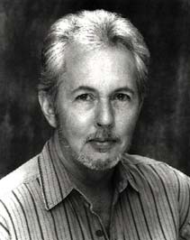
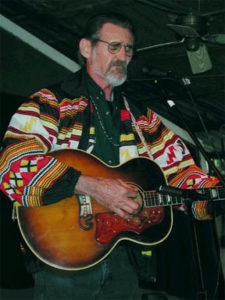
 

This slideshow requires JavaScript.


Dale Crider Bio for Apalachicola Doin’ Time documentary

Jeanie Fitchen Bio for Apalachicola Doin’ Time documentary

Steve Gillette Bio for Apalachicola Doin’ Time documentary

Mike Jurgensen Bio for Apalachicola Doin’ Time documentary

Harvey Reid Bio for Apalachicola Doin’ Time documentary

Ken Skeens Bio for Apalachicola Doin’ Time documentary

Mark Smith Bio for Apalachicola Doin’ Time documentary

Steve Gillette Bio for Apalachicola Doin’ Time documentary

The River

By Steve Gillette

Lyrics:
I’ve seen the paddlewheelers rolling south on a summer’s day
I’ve seen lovers at the guard rails with stars in their lemonade
And I’ve heard the hobos gather, heard the banjos grace the glade
Heard them sing about the river, called it the lazy man’s parade
Sing me that song about the river, green, going away
I always did feel like a drifter about this time of day
Last night I stood by the highway, pretended I was on my way
You know a hundred thousand headlights couldn’t match the milky way
And when the moonlight touches the water surely something touches me
And I go reaching for the river like it’s reaching for the sea.
chorus
Some things go on forever, the truth don’t ever change
The wind may brush the water, but the river holds her sway.
chorus
Compass Rose Music, Used with permission
More information about Steve’s music is available at his website

Musician Steve Gillette

Biography:
In a musical age created by the singer-songwriter, Steve Gillette has long been considered to be one of the finest. His music has inspired glowing reviews from the critics and the deep loyalty of his fans. Since Ian and Sylvia first recorded Darcy Farrow in 1966, Steve’s songs have been sung by dozens of major artists including Garth Brooks, John Denver, Nanci Griffith, Waylon Jennings, Gordon Lightfoot, Anne Murray, Tony Rice, Kenny Rogers, Linda Ronstadt, Spanky and Our Gang, Jerry Jeff Walker, Jennifer Warnes, Don Williams, and Tammy Wynette.

Steve’s first album, STEVE GILLETTE, originally released in the Spring of 1968, has recently been reissued by Vanguard on compact disc. The album includes guest performances by Buffy Saint Marie, Bruce Langhorne and Dick Rosmini. His second album, BACK ON THE STREET AGAIN, was produced by John Ware for Outpost Records, with help from Spanky McFarland and Emmy Lou Harris’ Hot Band. Steve’s third album ALONE…DIRECT (solo voice and guitar) was recorded by the direct-to-disc process and produced by John DelGatto on Sierra Records.

Graham Nash produced Steve’s fourth album, A LITTLE WARMTH, which was released on Flying Fish Records in 1979. Appearing on this album were Johnny Barbatta and Pete Sears from The Jefferson Starship, Graham Nash, David Lindley, and Jennifer Warnes.

Since their marriage in April of 1989, Steve Gillette and Cindy Mangsen have been traveling, performing and recording together. Their album LIVE IN CONCERT, recorded at the Ark in Ann Arbor, is available from their own company, Compass Rose Music, and was on many “10 Best” lists when it was released in 1991. A second duet album called THE LIGHT OF THE DAY was named Top Folk Album of 1996 by Rich Warren (WFMT, Chicago) and Matt Watroba (WDET, Detroit).

A collection of twelve of Steve’s original songs was produced in Nashville by Jim Rooney in 1992. The album, called THE WAYS OF THE WORLD (Compass Rose), features studio performances by Stuart Duncan, Mark Howard, Roy Huskey Jr., Kenny Malone, and Mark Schatz. Steve’s latest solo recording is entitled TEXAS AND TENNESSEE (Redwing Music, 1998), with back-up from Charles Cochran, Mark Graham, Mark Schatz, Pete Sutherland, Pete Wasner, Mike Williams and others.

Ken Skeens Bio for Apalachicola Doin’ Time documentary

Old Florida River

By Ken Skeens


Musician Ken Skeens

Biography:
Ken composes music in the tradition of Will McLean, about the preservation and protection of Florida. He’s produced two original CDs, An Empty Chair and Florida Spirit. He was the first winner of the Best Florida Song Contest at the Will McLean Festival in 1992, and served for many years as the director of the contest and a member of the Will McLean Executive Committee. Ken and his songwriting partner Leigh Goldsmith are regular performers in the Orlando area and at festivals throughout the state. They perform songs in harmony in an effort “to keep the spirit of Florida alive”

To learn more about Ken Skeens click here.

Dale Crider Bio for Apalachicola Doin’ Time documentary

Apalachicola Doin’ Time

By Dale Crider

Lyrics:
When she leaves the dam at Chattahoochee 
Winding in a southern flow 
Easy on her way — another night and day 
She’ll finally reach the Gulf of Mexico
Apalachicola River Water 
In veins of our land 
Alligators in her swampy borders 
Are a part of nature’s plan 
Give the word to protect her 
Call the technical sector 
Soften up the cry to drain the swampland dry 
Apalachicola let her wind 
Apalachicola strong in mind 
Apalachicola flowin’ fine–Lord 
Apalachicola doin’ time
So as we turn the page of natural history 
She’s windin’ in a southern flow 
Nursin’ in her waves 
The oysters in the bays 
This is just a part of nature’s role 
(Chorus)
© Dale Crider, Used with permission

Singer Songwriter Dale Crider

Biography:

Dale Crider, a retired wildlife biologist, has been an education specialist for the Florida Game and Water Fish Commission for more than three decades. As both singer and biologist, Dale has spent his life convincing people that Florida wildlife habitats, and the plants and animals dependent on them, should be diligently preserved. Learn more about Dale by clicking here.

Harvey Reid Bio for Apalachicola Doin’ Time documentary

Circles

By Harvey Reid

Lyrics:
I throw a stone into the water and I watch the circles as they grow
While holidays and birthdays leave footprints like soldiers in the snow
The flowers and the icicles are spokes in a wheel that has no end
And the passing of the seasons makes me think about circles again

The sun and the moon, circles tracing circles in the sky
While old people and children look at each other in the mirror in the eye
Like the turning of a waterwheel like the voice of a long lost friend
When I think about my old friends I think about circles again

Round and round and round in circles we spin
Over and over we end up right where we begin
Those things that never change, those things that are never the same
Though it looks like a straight road I’m traveling in circles again

These round coins in my hand there’s so much I do that they ask me
What goes around will come around; there are wheels turning night & day right past me
I had a dream long ago I was hiding but a clock always found me
And now everywhere I look I see circles all around me

1991 by Harvey Reid (Quahog Music BMI) Used with permission.

Singer Songwriter and Musician Harvey Reid

Biography:
Songwriter and multi-instrumentalist Harvey Reid has honed his craft since the 1970s in countless clubs, festivals, streetcorners, cafes, schools and concert halls across the nation. He has been called a “giant of the steel strings” and “one of the true treasures of American acoustic music,: and is considered to be one of the modern masters and innovators of the acoustic guitar, autoharp and 6-string banjo. He has absorbed a vast repertoire of American contemporary and roots music and woven it into his own colorful, personal and distinctive style. His 32 recordings on Woodpeckers Records showcase his mastery of many instruments and styles of acoustic music, from hip folk to slashing slide guitar blues to bluegrass, old-time, Celtic, ragtime, and even classical.

Reid is also the author of dozens of music education books as well as an important visionary and pioneer in modern troubadour education. He is the creator of the Liberty Guitar Method, a ground-breaking advance in beginning guitar.
Reid’s skills and versatility on the guitar alone mark him as an important new voice and one of the deepest artists in acoustic music.

He won the 1981 National Fingerpicking Guitar Competition and the 1982 International Autoharp competition. Yet he’s also a veteran musician with a long list of studio and band credits, a strong flatpicker who has won Bill Monroe’s Beanblossom bluegrass guitar contest, a versatile and engaging singer, a powerful lyricist, prolific composer, arranger and songwriter, a solid mandolin, mandocello and bouzouki player, and a seasoned performer and captivating entertainer.

Harvey Reid maintains an extensive website that has the lyrics, liner notes, guitar tunings and more for all of his songs.

Mike Jurgensen Bio for Apalachicola Doin’ Time documentary

Music Drifts Along this River

By Mike Jurgensen

Margaret

Singer Songwriter Mike Jurgensen

Biography:
Michael Jurgensen has lived in the Tampa Bay area since 1968, when he moved from his native Chapel Hill, NC. Mike began playing the guitar when he was seven years old, but it was not until 1992 that he began performing in public seriously. It was then that he discovered the Iron Horse coffee house in Tarpon Springs, where he began playing open mics. Over the next two years he branched out to do open mics and feature sets at other Tampa Bay area coffee houses and restaurants, as well as regularly emceeing the Iron Horse open mics.

He has also played at several local fairs and festivals, and he has been the featured artist a number of times on various live radio shows on WMNF in Tampa. Although Mike had written several songs prior to 1992, he has only been writing seriously since 1992. Mike was a finalist in the 1994 and 1996 South Florida Folk Festival song-writing competitions, and he won the Best New Florida Song award at the 1998 Will McLean Festival.

In April of 1994 Mike joined the well-known Florida acoustic group, Myriad, which had been together for about 4 years at the time. Together with Myriad, he played concerts at coffee houses, radio shows, benefit concerts, and festivals around the state. The group also has several recordings including two CDs, “Song Circle” and “New Strings.” Mike also has a solo recording project.

In recent years he has performed as part of the trio known as 2PM featuring Mike, Pete Price and Pete Hennings. The trio has performed at a wide variety of Florida festivals and music venues and has three CDs: “Keepin’ Time,” “Let’s Just Play One More,” and their newest project, “Writing on the Wall.”

More information on Mike’s group “2PM” is available at their website. To hear more of Mike’s music click here. Mike can also be reached by mail: 6985 Coronet Dr. / New Port Richey, Fl 34655

Mark Smith Bio for Apalachicola Doin’ Time documentary

Wisdom of the River by Mark Smith


Singer Songwriter Mark Smith

Lyrics:
I have seen a river, and a river has seen me
I have felt its current flowin’ to the sea
In its deep reflection are scenes from yesterday
The wisdom of the river is showin’ us the way
The landscape is the canvas…the water is the brush
Painting out a poem in the stillness and the hush
Then a whisper from a whirlpool takes a shadow for a ride
And the wisdom of the river has found its way inside
When the river talks I…wanna listen, wanna pay attention now, don’t be slow.
When the river talks I…wanna listen, cuz it might say something I wanna know
With skin of fluid motion, that paddle can caress,
It holds me like a lover unafraid to be undressed
With secrets barely hinted, not quite an open book
The wisdom of the river invites a closer look.
(repeat first verse)
Mark Smith, Used with permission

Biography:
Raised on the St. Johns River and in the salt marshes of coastal Northeast Florida, Mark developed a passion for his native Florida at an early age. Always one to find a song in seemingly obscure moments or places, Mark brings the subtleties of Florida’s landscapes and history to life in his original music.
With three albums to his credit, Mark has toured Florida since 1992 performing at numerous established folk venues. He has appeared numerous times at the prestigious Florida Folk Festival in White Springs. He lives in Gainesville.
Mark Smith is accessible via email or regular mail at 2027 NW 56th Terrace / Gainesville, FL 32605.